
Hurricane Dorian updates for Friday, Aug. 30, 2019
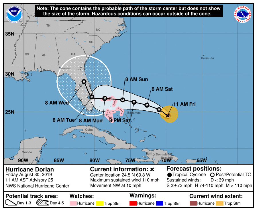
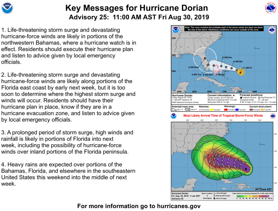
Hurricane Dorian is slowing its roll but continues to threaten to barrel into Florida’s coast with a Category 4 assault early Tuesday, the National Hurricane Center reported at its 11 a.m. update.
The center line of the morning’s forecast takes aim at the border of Palm Beach and Martin counties, but that is no guarantee that’s where Dorian will make landfall, with all of the state’s coast in the cone of probability.
With the slow down in forward speed, the earliest South Florida could feel tropical storm-force winds is early Sunday morning, with Central and North Florida feeling them later in the afternoon and evening. The most likely arrival time of winds is late Sunday for southeast Florida and as late as Monday night for North Florida.
Meteorologists said their biggest concern will be Dorian’s sluggish crawl as it nears Florida, placing some areas of the state at an increasing risk of a” prolonged, drawn out event of strong winds, dangerous storm surge and heavy rainfall.”


It is so hard waiting on the hurricane to get here. I know they are really busy on the coast getting ready, and God protect them. It could be devastating, and probably will. It will probably (hopefully) die down in intensity by the time it gets here. My concern is still the trees around my apartment and what I have to leave on the patio because I really have no place to put it. I decided to put a few things in the trunk of my car. I don’t want to bring them inside. Bugs!!! The stuff I put in the trunk will be in a bag and less likely to have bugs in it. Problem is, you an never tell.
LikeLiked by 1 person
Good idea to put plants in your trunk temporarily.
LikeLiked by 1 person
Just talked to my retired Army/Miami PD friend – he’s headed down to Cosco to but a few more cases of beer – he’s good on booze and MREs – in case he has to ride this out. He rode out Andrew on the PD so he’ll get to enjoy this one as a spectator.
LikeLiked by 1 person