
Two new hurricanes coming on – Gabrielle (Atlantic Ocean) and Juliette (Pacific Ocean) – but first, news about Dorian.
![]()
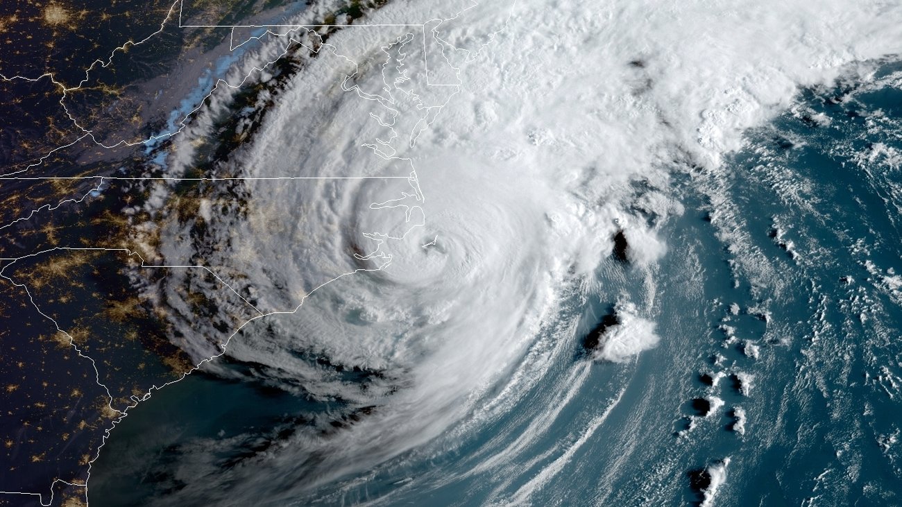
DORIAN IS PRODUCING HURRICANE-FORCE WINDS IN THE OUTER BANKS …
10:00 AM EDT Fri Sep 6
Location: 35.4°N 75.2°W
Moving: NE at 14 mph
Min pressure: 956 mb
Max sustained: 90 mph
Hurricane Dorian finally made landfall Friday morning, its eye passing over Cape Hatteras, N.C. at 8:35 a.m. ET, the National Hurricane Center says. Its maximum sustained winds were near 90 mph — making Dorian a Category 1 storm when it hit.
Despite making landfall, Dorian won’t linger the way it did to devastating effect in the Bahamas. It’s moving northeast at 14 mph, the NHC says in its 9 a.m. ET update.
Dorian is extending hurricane-force winds for up to 45 miles from its center; tropical storm-force winds extend outward for up to 220 miles. Raising the risk of flooding, northeastern North Carolina is forecast to get an additional 3-8 inches of rain, with isolated totals of 15 inches possible.
Parts of North Carolina and Virginia remain under a hurricane warning — but in a sign of the storm’s predicted path over the open Atlantic Ocean, the only hurricane watch now in effect is for Nova Scotia.
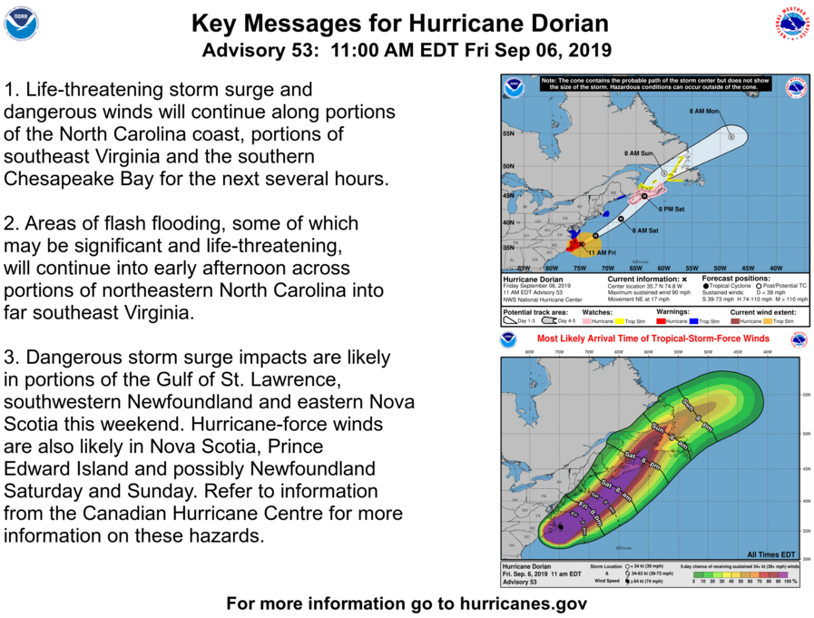
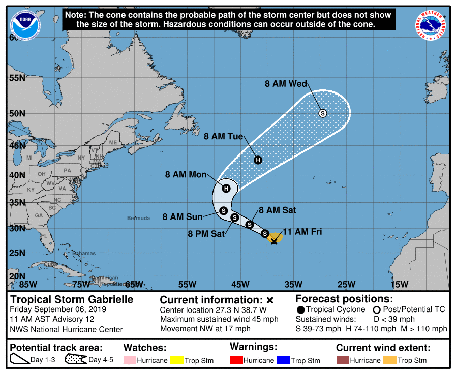
![]() …GABRIELLE QUICKLY REGENERATES INTO A TROPICAL STORM… …EXPECTED TO BECOME A HURRICANE EARLY NEXT WEEK…
…GABRIELLE QUICKLY REGENERATES INTO A TROPICAL STORM… …EXPECTED TO BECOME A HURRICANE EARLY NEXT WEEK…
11:00 AM AST Fri Sep 6
Location: 27.3°N 38.7°W
Moving: NW at 17 mph
Min pressure: 1003 mb
Max sustained: 45 mph
![]() …JULIETTE SHOULD CONTINUE TO GRADUALLY WEAKENING DURING THE NEXT COUPLE OF DAYS…
…JULIETTE SHOULD CONTINUE TO GRADUALLY WEAKENING DURING THE NEXT COUPLE OF DAYS…
5:00 AM HST Fri Sep 6
Location: 22.8°N 123.4°W
Moving: WNW at 12 mph
Min pressure: 987 mb
Max sustained: 75 mph
Juliette is off the Pacific Coast of North America, headed towards Mexico.

![]()
For further information, visit the NATIONAL HURRICANE CENTER


Well… Here in Jersey
It is raining and the wind has kicked up a notch
💦💦💦🌊💦💦💦☔☔☔💦💦💦🌊💦💦💦
LikeLike